Inside you’ll find: All the tools you’ll need to put together an awesome homeschool geography curriculum.
Your kids rocked their math lesson, read some great books, and loved their science experiment.
You’re feeling pretty good about your homeschool day. Then you remember with a stab of guilt, the often overlooked subject of GEOGRAPHY. Groan.
If it sounds dry and monotonous, let me show you some easy ways to make geography come alive for you and your students!
 This post contains affiliate links for your convenience. Read my full disclosure policy here. A big thanks to Pin It! Maps for giving us some of their products for me to review!
1.Living Books
Remember that history and geography are indelibly linked. If you don’t include geography in your homeschool history, you’re likely to end up with more of a black and white picture of the past, than a vividly colorful one.
So choose fantastic history books (we LOVE Beautiful Feet Books) and you’ll find your students asking geography questions quite naturally!
There are also tons of living, rich fictional books that get kids interested in land and sea formations.

Any book by Holling C Hollings is a slam dunk for living geography books. We loved Paddle-to-the-Sea (about the great lakes region and St. Lawrence river). Now we’re in the middle of reading Tree in the Trail
about the Santa Fe Trail, native Americans and western expansion. There’s also Pagoo
(tide pools) Seabird
(world geography) and Minn of the Mississippi
(Mississippi river). The illustrations will have you staring for a VERY long time!

Give Your Child the World: Raising Globally Minded Kids One Book at a Time This is a book for you mama! A fantastic book list divided by global regions as well as age groups. I’ve found it very helpful!
We’re slowly reading picture books from around the globe and compiling our favorites for you. So far we’ve traveled to the Middle East and Asia.
2. Puzzles in the Shape of the Countries
After playing with these puzzles, my mom remarked, “I feel like I understand SO much better how everything fits together, literally!” It’s weird, but something about the tactile, kinetic input, makes assembling puzzles one of the best ways to really grasp geography.

The best quality map puzzles out there are the Montessori ones! They have everything, Europe, Africa , USA , Asia North America, Australia
, South America, and
Canada
But they can be quite expensive (they’re made out of high quality wood!) We found some made out of high quality cardboard, but sadly they’re no longer made. I’ve also had many folks recommend the GeoPuzzles – World Map & Jigsaw Puzzle as a decent middle ground alternative.

3. Draw It
To really become competent with geography, students need to interact with maps.

One way to do this is with the series of books called Draw the World: An Outline of Continents and Oceans. They also have specific books for different locations, like Draw the USA
. With just five minutes of work here and there, students are able to accurately draw the political maps of the world. My boys aren’t quite old enough yet, but a lot of my homeschooling buddies RAVE about this series and we plan to start using it soon.
4. Map Work
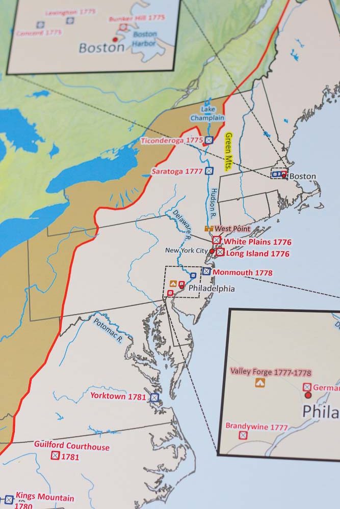
I’ve saved my favorite for last. Have you heard of Pin It! Maps? They’re the ultimate in map work!
They have tons of maps that are backed by thick Styrofoam. There are bunches of pin “flags” that students place all over the map, depending on what they’re working on. The are pins for everything you can think of, from state names, state flags, cities and capitols, land formations and national parks, water features and more!
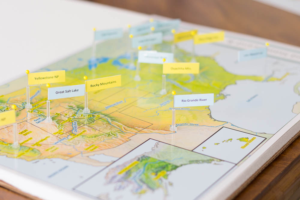
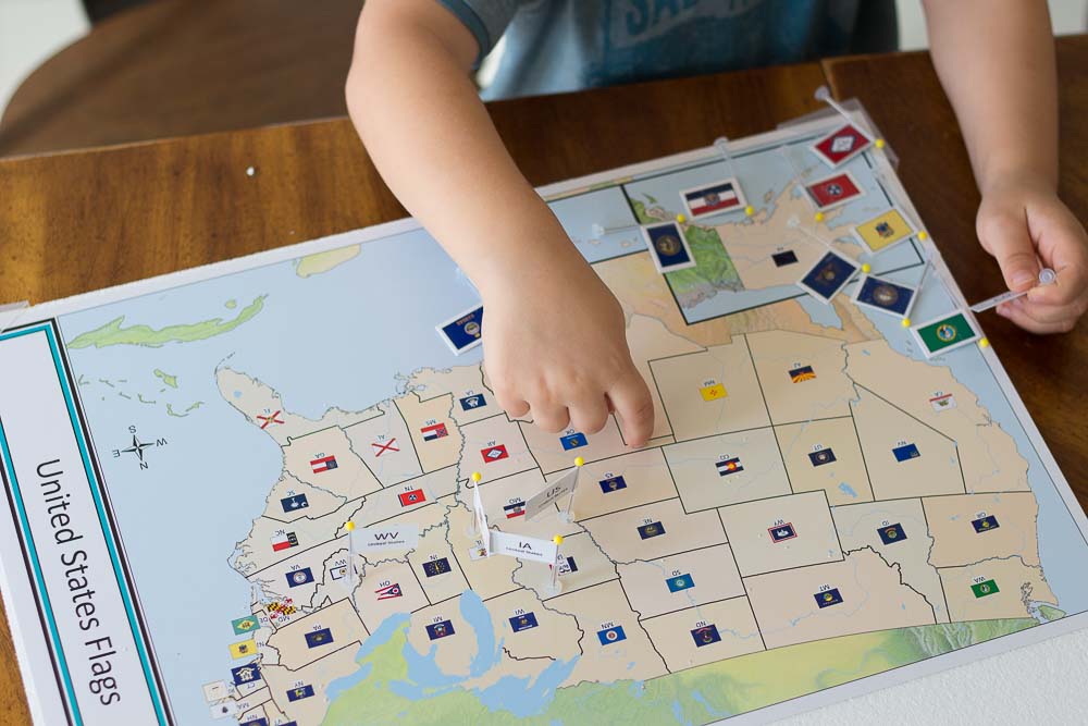
Now, there isn’t just one map for each geographic area, oh no! With the US and US history bundle, there are three LARGE 18″ by 24″ a maps that are marked with things like US History from the 1800s, Early America.

Then there are 11, yes eleven, smaller maps (still substantial at 12″ by 18″) with markings like state flags, native american tribes, battle sites from the Revelation, the War of 1812, and the Civil War. The 13 colonies have their own map and so much more.
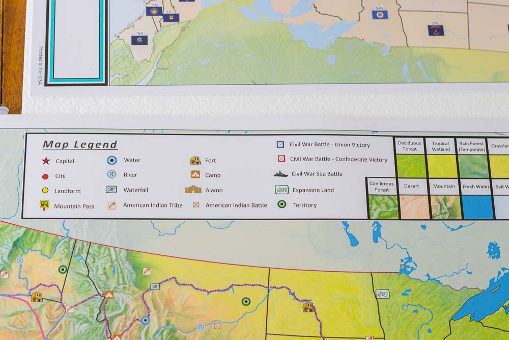
As you can see, these maps are loaded with details!
These Pin It! Maps will grow with us all the way through high school I’m sure. Since geography touches so much of every day learning, we’ll be busting these out regularly.
Since we’re getting ready to road trip from Austin, TX to Boston, MA, we’re doing map work specific to the trip. I’ve pulled out states and cities we’ll be passing through, as well as national parks and water features we’ll be seeing (hello Niagara Falls!).
Julie is a frazzled mom of three tornadoes. As a dorky second-generation homeschooler, she writes about learning and play, natural living, special needs parenting and matters of the heart. She serves an astounding God that radically saved her.
Follow My Mundane and Miraculous Life through social media!


![]()
[…] Fun & Simple Homeschool Geography Curriculum and Resources – My Mundane & Miraculous Life […]